Skip to content Skip to main navigation Skip to footer

Month: March 2018

El Dorado County Unveils New Interactive Road Work Website

El Dorado County has unveiled a new interactive website that details road work projects.

El Dorado County today launched a new website dedicated specifically to road work projects that have been completed, are currently being done, or are slated to begin this calendar year. Of the 100 projects listed, 58 are maintenance projects, 28 are storm damage projects, and 14 are capital improvement projects. These projects collectively account for nearly $100 million in cost to complete.

“One of the issues of concern to most County residents is the condition of our 1,080 miles of roads. This new website allows residents to easily see where progress has been made, what’s coming up in terms of road repair and what’s currently under construction,” said Department of Transportation Director, Rafael Martinez. “It also provides users with funding information and a timetable for estimated completion of most projects. It will be a constantly evolving site as our employees work to make the roads safe in our County.”

The site contains an interactive overview map of the county with each project marked with different icons indicating whether the project is related to storm damage repair, maintenance or capital improvement and where it is along the continuum of construction.

When a user clicks on an icon, the page moves to screen that provides the project description, estimated cost, estimated construction date (or completion) and the funding source. Many of the projects also include images of construction. Additionally, when a user selects a project, a second map appears on the right side of the screen that displays a zoomed-in location of the larger map highlighting the precise location of the project. Finally, users can also search for projects by name.

Because of the complexity of the mapping features, the functionality of the site works best on Chrome rather than Internet Explorer.

“This website is another tool the County is using to be transparent, keep residents informed and even provide additional information that they may find useful.

Visit the the new interactive website HERE
 

APAC March 14, 2018 Meeting Agenda Available Online

The El Dorado Hills Area Planning Advisory Committee has posted the Agenda for the March 14, 2018 meeting, to be held at the El Dorado Hills Community Services District Norm Rowett Pavilion at 1021 Harvard Way in El Dorado Hills CA.

Some Topics to be covered

Guest Speakers- Louis Mansour of the Mansour Company, updating us on Town Center West, and the TCW Apartments

Supervisor Communications: Supervisor John Hidahl

EDH APAC VOTE: Cleanup Amendments to the APAC Guidelines with respect to posting of Agendas and the start of term for APAC officers.

UPDATE- Serrano Village J Lot H – Planning Commission Hearing scheduled for April 12, 2018 at 8:00AM.

***UPDATED Tuesday March 13, 2018: Amended two additional Projects***

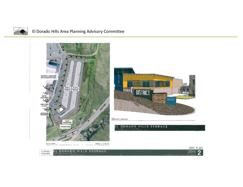
PA18-0001 First Rate Storage Rossmore Lane area – Pre Application for Self Storage Facility on 5.5 acres off Rossmore Lane, east of Town Center.

El Dorado Hills Business Park Owners Association Proposal to De-Annex 207 Acres Owned by DST at the south end of the Business Park, for potential residential housing.

Loader Loading...
EAD Logo Taking too long?

Reload Reload document
| Open Open in new tab

Download FULL Agenda HERE [377.48 KB]


Notice Of Public Hearing Serrano Village J Lot H April 12, 2018

The County of El Dorado Planning Commission will hold a public hearing in the Building C Hearing Room, 2850 Fairlane Court, Placerville, CA 95667 on April 12, 2018, at 8:30 a.m., to consider Tentative Subdivision Map TM14-1524/Planned Development PD14-0008/Serrano Village J Lot H submitted by SERRANO ASSOCIATES, LLC to request the following: 1) Serrano Village J-Lot H Tentative Subdivision Map consisting of 41 single-family detached residential lots ranging from 7,200 to 17,077 square feet in size, two landscape lots, one open space lot, and a 12.53 acre-lot for a future recreational park. This map replaces the approved 83-unit tentative map approved under TM10-1498; 2) Development Plan for the Serrano Village J-Lot H Tentative Subdivision Map with modifications to applicable residential development standards in the Zoning Ordinance. This Development Plan replaces the previously approved Development Plan under PD10-0003; and 3) Design Waiver of El Dorado County Design and Improvement Standard Manual (DISM) standards: Modification of subdivision road improvement Standard Plan 101 B: A) Reduction of right-of-way width from 50 feet to 38 feet, reduction; B) Construction of 4-foot wide sidewalk along one side of the residential road instead of 6 foot sidewalks on both sides; and C) Construction of modified rolled curb and gutter instead of vertical curb. The property, identified by Assessor’s Parcel Numbers 123-370-01, 123-370-03, and 123-280-10, consisting of 25.27 acres, is located approximately 1½ miles north of Highway 50 along Bass Lake Road, at the intersection with Serrano Parkway, in the El Dorado Hills area, Supervisorial District 1. (County Planner: Mel Pabalinas) (Statutory Exemption pursuant to Section 15182 of the CEQA Guidelines)**

Loader Loading...
EAD Logo Taking too long?

Reload Reload document
| Open Open in new tab

Download Full Document [97.30 KB]

TM14-1524 Village J Lot H Project Documents Page

South Of 50 Folsom Information

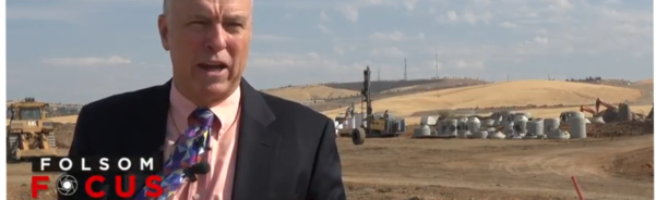
A video produced in conjunction with folsomchamber.com in late 2017 with information about some of the details, and proposed solutions regarding the City Of Folsom South Of 50 project. Some items addressed include traffic, schools, water, utilities, and housing inventory.