Skip to content Skip to main navigation Skip to footer

News

August 11, 2021 APAC Meeting In Person At EDH Fire Station 85, also Streaming Via Zoom and YouTube

Find the meeting details on the event page

Meeting in Hybrid Format

The August 11th EDH APAC meeting is being held in-person at the El Dorado Hills Fire Department Station 85 Meeting Room, located at 1050 Wilson Blvd, in El Dorado Hills. The meeting start time is 7:00PM

Since this will be the first in-person meeting for EDH APAC since restrictions for public gatherings were implemented in 2020, and because many community members find value in being able to attend EDH APAC Meetings virtually, the meeting will also be streamed via Zoom – https://us02web.zoom.us/j/84531672523

Additionally, because the meeting topics are expected to draw increased attendance, EDH APAC will also attempt to stream the Zoom virtual session via the EDH APAC YouTube Channel – the live YouTube meeting link is https://youtu.be/kNmI-t_z6fE

The in-person attendance is limited to 114 guests. The EDH APAC Zoom Webinar attendance is limited to 100 attendees. Because of the these limits, if the Zoom session maxes out on attendees, Zoom will prompt every attendee beginning with the 101st attendee to follow the meeting live stream on YouTube. YouTube attendees will not be able to participate in the discussion, but will be able to view the live video, and hear the live audio.

REMINDER

Because EDH APAC has not conducted an in-person meeting in over a year, and also because meeting topics may be viewed by some members of the community as controversial, we offer these EDH APAC Meeting reminders:

  • PUBLIC COMMENTS are limited to three minutes, to allow all attendees the opportunity to participate.
  • PUBLIC COMMENTS on matters not on the published agenda are heard at the beginning of the meeting, at a designated time.
  • Courtesy is extended to all attendees from the Community, as well as to all speaking guests, and project applicants.
  • When public comment and questions from the community begins, we ask attendees to come forward to use the microphone – this allows all attendees to hear the comments and questions, both in-person, and for our streaming attendees. We cannot accept questions shouted from the audience.
  • Keep comments and questions short and focused – 1 or 2 questions/comments are permitted.
  • If your question has been asked, please do not repeat the same questions – we only have a limited time availability to use the meeting space.
  • Courtesy is expected in allowing guests to respond to questions and comments without interruption.

EDH APAC strives to make sure that our public discussions remain civil. Development projects can be controversial, for both supporters and for those who may be opposed. It is human nature to be motivated by emotion, but in EDH APAC’s experience of 40 years of reviewing proposed projects, we have found that emotion tends to cause decision makers to tune out the community’s concerns – and we have been guilty of that in the past too, just like any other community members. We’re committed to better, more effective, communication.

EDH APAC is not focused on supporting a project, or denying a project – we have no land use authority – EDH APAC strives to review proposed projects in a thoughtful informed manner, so that when we provide our findings, that they are based in facts, and reason. This allows the community’s concerns, questions, and suggestions, to be heard by the project applicants, the County Planning process, and our elected decision makers. EDH APAC’s goal is not to see a project approved, or denied, but to result in the best possible project outcome for El Dorado Hills residents, the County, and the project applicants. EDH APAC never seeks advocacy to support or oppose a project.

We’re excited to welcome the El Dorado Hills Community back to in-person public meetings – your participation is valuable.

Intersection Improvements – Silva Valley Parkway at Harvard Way

El Dorado County announces road construction activities beginning July 12th through September 30th

From the El Dorado County Press Release:

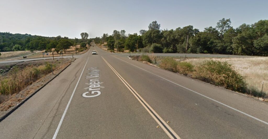
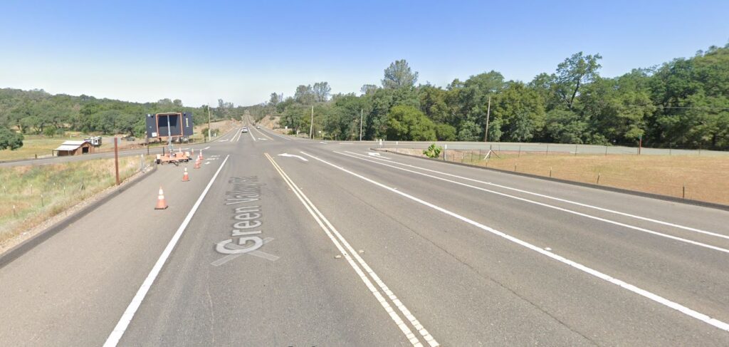
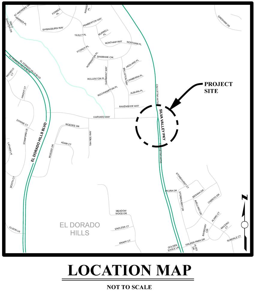
(PLACERVILLE, CA) — El Dorado County’s Department of Transportation will be performing road work at the intersection of Silva Valley Parkway and Harvard Way in El Dorado Hills beginning the week of July 12 through September 30, 2021. The construction work will require occasional lane and shoulder closures for which motorists should expect delays.

The closures are necessary to ensure motorist and worker safety while the County’s contractor constructs additional capacity in right and left turn pockets in both directions and adding a southbound through lane at the intersection on Silva Valley Parkway. Additionally, the project will improve bike lanes, Americans with Disabilities Act (ADA) requirements at the crosswalks and curb ramps, and optimize the traffic signals for safety and efficiency.

Every effort will be made by the County’s contractor to minimize any impacts to school drop off and pick up times while school is in session.

Motorists are advised to slow down through the work zone and expect delays during reversing traffic control. Motorists are also advised to allow extra time when traveling through the work zone in order to arrive at their destinations on time.

The County sincerely appreciates the cooperation and patience of motorists that use this roadway and we apologize for any inconvenience as a result of these closures.

For questions regarding this construction, please contact the County’s Transportation main line at (530) 621-5900 (select Option 3 for Engineering).

Central El Dorado Hills Specific Plan Notice of Availability of SECOND Recirculated Draft Environmental Impact Report

Released April 30, 2021 – comment/review period closes June 14, 2021

El Dorado County Planning Department has released the Notice of Availability of a Second Recirculated Draft Environmental Impact Report, which reflects changes to CEQA that removes Level of Service metrics for transportation impacts, and instead implements the Vehicle Miles Traveled metric. The Project also has been updated with new alternate use scenarios for the old El Dorado Hills Executive Golf Course property that is currently zoned as Recreational Facility – High (RF-H).

Loader Loading...
EAD Logo Taking too long?

Reload Reload document
| Open Open in new tab

Download NOTICE [311.89 KB]

The Second Recirculated DEIR is located on the Project DOCUMENTS page here

Project Alternatives 4 and 5

The Second recirculated DEIR contains two new project alternatives –

Alternative 4 Zoning-Consistent Alternative

RF zoning provided for certain types of active recreational facilities such as picnic areas, ball fields and courts, playgrounds, golf courses, and swimming pools for day use only, as well as passive opportunities such as riding and hiking trails. For both active and passive uses, no special use permit or variance was required, but a project required site plan review.

The Serrano Westside planning area under this alternative would include residential development (135 units) on the hillsides or ridgelines, which would not occur with the proposed project. Instead of residential development, the former Executive Golf Course would be entirely in active recreation. While exact uses in this recreation area have not been defined, they could include a tennis and aquatics facility, day-use and night-use sporting fields, amusement complex, indoor or outdoor entertainment facilities, hotels, and general merchandise sales or potentially indoor/outdoor golf ranges, ice-skating rinks, or other recreational uses that involve large structures and require parking lots. Residential development on the Pedregal planning area (375 units) would be more dense as compared to the project (37 units).

Alternative 5 Senior Living Alternative

The Senior Living Alternative would include residential development similar to the proposed project on the Pedregal planning area and the northern portion of the former Executive Golf Course. The former Executive Golf Course south of Serrano Parkway would be developed as a senior living facility. The senior living facility assumes a continuing care retirement community (CCRC), which provides residential services, on-site amenities and recreation, and health care. As with the proposed project, a County General Plan amendment and EDHSP amendment would be required. The Senior Living Alternative would consist of developing 37 detached, single-family residential units at a density of <1–5 dwelling units per acre on the Pedregal planning area, identical to the proposed project, 226 single-family residential units at a density of 8–14 dwelling units per acre on the Serrano Westside planning area north of Serrano Parkway, and 300 attached, multi-family residential units at a density of 14–24 dwelling units per acre in both planning areas. The former Executive Golf Course south of Serrano Parkway would be developed as a senior living facility with 1,000 independent living dwelling units and 200 assisted living dwelling units. Open space and parkland would be dedicated. This alternative would include 11 acres of civic–limited commercial land use.

Public Workshop Scheduled for the May 27, 2021 Planning Commission meeting

The Second RDEIR is scheduled for a public workshop before the Planning Commission on May 27, 2021. The purpose of this workshop is to present information on the RDEIR and receive public input; no formal action will be taken.

Serrano Associates are scheduled to present an overview of the Second Recirculated DEIR and new Project Alternatives at the May 12, 2021 El Dorado Hills APAC meeting

Montano de El Dorado Phase 2 Public Hearing March 25th

The County of El Dorado Planning Commission will hold a public hearing on March 25, 2021 at 8:30AM to consider:

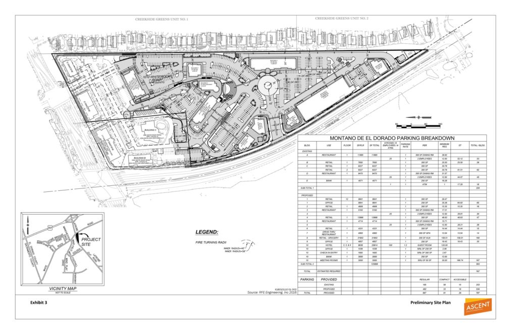
Rezone Z15-0002/Tentative Parcel Map P15-0006/Planned Development PD15-0004/ Conditional Use Permit S17-0015/Montano De El Dorado Phase I and II Master Plan submitted by MONTANO VENTURE 2, LLC to: 1) Rezone (Z15-0002) from Regional Commercial – Community Design Review Combining Zone (CR-DC) to Regional Commercial – Planned Development Combining Zone (CR-PD); 2) Commercial Tentative Parcel Map (P15-0006) on Assessor’s Parcel No. 118-010-012 to create a total of 12 commercial parcels from an existing 16.85-acre parcel, ranging from 0.72 acres to 3.48 acres in size, as part of proposed Phase II of the Montano De El Dorado Master Plan; 3) Planned Development (PD15-0004) to establish a Development Plan for the existing Montano De El Dorado Phase 1 development and the proposed Phase II expansion. Phase I consists of an existing commercial center, consisting of five buildings, on the 20.1-acre project site with a combined total of 39,645 square feet of floor area.  Existing uses include retail stores, restaurants, and a bank. The proposed Phase II expansion consists of nine additional commercial buildings with a combined total of approximately 80,000 square feet of retail, restaurant, commercial and office uses, a 55,136 square foot, 100-room hotel, a small community pavilion and on-site parking, lighting, signage and landscaping; and 4) Conditional Use Permit (S17-0015) to allow outdoor special events and office uses within existing Phase I and proposed Phase II of the Montano De El Dorado Master Plan. The properties, identified by Assessor’s Parcel Numbers 118-010-012, 118-010-014, 118-010-015, and 118-010-016, consisting of 20.1 acres, is located approximately 0.5 mile south of U.S. Highway 50 on the east side of Latrobe Road at the intersection with White Rock Road, in the El Dorado Hills area, Supervisorial District 2. (County Planner: Tom Purciel, 530-621-5903)  [An Environmental Impact Report (EIR) (State Clearinghouse No. 2017072027) consisting of a Draft EIR and Final EIR has been prepared for the project]

County Staff Reports and the project Final Environmental Impact Report (FEIR) as referenced in the Public Notice, have not yet been made available on the County’s Legistar website, or on the County’s eTRAKiT website. Project Documents are typically available about two weeks prior to a public hearing.

Any written correspondence should be directed to the County of El Dorado Planning and Building Department, 2850 Fairlane Court, Placerville, CA 95667 or via e-mail: planning@edcgov.us.

To ensure delivery to the Commission prior to the hearing, written information from the public is encouraged to be submitted by Thursday the week prior to the meeting. Planning Services cannot guarantee that any FAX or mail received the day of the Commission meeting will be delivered to the Commission prior to any action.

The EDH APAC Project Documents Page is HERE

Loader Loading...
EAD Logo Taking too long?

Reload Reload document
| Open Open in new tab

Download NOTICE [136.83 KB]


Notice of Public Hearing Feb 23, 2021 Carson Creek Village Specific Plan Conceptual Review

J6 Conceptual Review at the Board of Supervisors

The County of El Dorado Board of Supervisors will hold a public hearing in the Supervisors Meeting Room, 330 Fair Lane, Placerville, CA 95667 on February 23, 2021, at 1:00 p.m., to consider Pre-Application PA20-0002/Carson Creek Village Specific Plan Conceptual Review submitted by ANDREA MATARAZZO/PIONEER LAW GROUP for an Initiation Hearing (Conceptual Review) of a proposed Specific Plan that would allow medium- and high density attached and detached residential development with a potential build-out of 600 to 800 dwelling units, approximately 110,000 square feet of new commercial floor area, approximately 8.5 acres for a park and paseo site, and approximately 26.5 acres of open space. The property consisting of 98 acres, is located within the central portion of the existing El Dorado Hills Business Park, along the west side of Latrobe Road, north of the intersection with Golden Foothill Parkway

Loader Loading...
EAD Logo Taking too long?

Reload Reload document
| Open Open in new tab

Download NOTICE [281.41 KB]

El Dorado Hills APAC Project Document Page

Notice of Preparation of a Draft Environmental Impact Report for the Creekside Village Specific Plan

Review Period November 6, 2020 – December 7, 2020

County of El Dorado will be the Lead Agency and will prepare an Environmental Impact Report (EIR) for the proposed Creekside Village Specific Plan (proposed project) located in unincorporated El Dorado County (County). This Notice of Preparation (NOP) initiates the environmental scoping process in accordance with the California Environmental Quality Act (CEQA) Guidelines (14 California Code of Regulations [CCR] Section 15082). The purpose of an NOP is to provide sufficient information about the proposed project and its potential environmental effects to allow public agencies, organizations, tribes and interested members of the public the opportunity to provide a meaningful response related to the scope and content of the EIR, including feasible mitigation measures and project alternatives that should be considered in the EIR.

El Dorado County is soliciting written comments from public agencies, organizations, and individuals regarding the scope and content of the environmental document. Because of time limits mandated by State law, comments should be provided no later than 5:00 PM on Monday, December 7, 2020.

Virtual Public Scoping Meeting Scheduled

El Dorado County will hold a scoping meeting to receive verbal comments regarding the scope and content of the environmental document and answer general questions regarding the environmental process. Due to COVID-19 social distance requirements, the scoping meeting will be held remotely. The meeting will be on Thursday, November 19, 2020 from 6:00 to 7:00 PM.

Attendees can observe and participate via live stream of the scoping meeting by going to this website:
https://rebrand.ly/CreeksideVillageScoping
Attendees can also participate and join by phone: 1-669-900-6833 or 1-929-205-6099 Webinar ID 924 1489 7860

About the Project

The project site is located south of Highway 50, west of Latrobe Road and south of Investment Boulevard in the El Dorado Hills area (APN 117-010-012), see Figure 1. The project site is bordered on the north by the existing El Dorado Hills Business Park and the John Adams Academy Charter School, to the east by the Blackstone master planned community (Valley View Specific Plan), to the south by undeveloped rural residential and industrial lands, and to the west by undeveloped land in the Carson Creek Specific Plan zoned for research and development.

The project applicant proposes to develop a new 926-unit residential community located on an approximately 208-acre site. The project would include 115.9 acres of single-family low-density residential development, 21.0 acres of single-family medium-density residential development, 14.3 acres of parks, 46.3 acres of open space preserves and buffers, and 10.4 acres of roadways.

The current zoning and General Plan land use designation for the project site is Research & Development (R&D). The project would require a general plan amendment from R&D to AP – Adopted Plan and a rezone from R&D to SP – Creekside Village Specific Plan and establish a Specific Plan for Creekside Village.

The Creekside Village Specific Plan includes a single-family low-density residential land use designation that would include single-family residential, accessory dwelling units (ADUs), and junior ADUs1 as well as neighborhood and community serving amenities such as parks, community clubhouses, and emergency services facilities. Low-density development would range from 4 to 8 dwelling units per gross acre, with a target dwelling unit count of 676. The single-family medium-density residential land use designation would allow for single-family dwellings, and two- and three-family dwellings as well as parks and public facilities. The draft Tentative Map includes two parcels designated for future development of medium-density residential that would range from 8 to 12 dwelling units per gross acre with a target dwelling unit count of 250.

Three parks are proposed: an 8.8-acre village park in the northeast area along Latrobe Road, a 3.3-acre neighborhood park in the south central area of the site, and a third 2.2-acre park located in the southeast corner of the site. The proposed Open Space Preserve designation would protect intermittent
drainages, seasonal wetlands, vernal pools, and ponds extending from the west to the northeast part of the project site. An Open Space buffer would be located along the western, northern, and southern borders of the site, as well as along Royal Oaks Drive.

El Dorado Hills APAC Creekside VIllage Project Douments Page
Loader Loading...
EAD Logo Taking too long?

Reload Reload document
| Open Open in new tab

Download NOP of DEIR [7.34 MB]

EDCTC El Dorado Hills Business Park Community Transportation Plan Virtual Open House

Virtual Open House Scheduled for October 22 5PM – 6:30PM

The El Dorado County Transportation Commission (EDCTC) is hosting a Virtual Open House on October 22, 2020 from 5:00 – 6:30 PM. During the Open House, you will be able to learn more about the Transportation Plan and provide your feedback on the proposed improvements.

2017, the El Dorado Hills (EDH) Business Park Owners Association started pursuing a new vision for the business park
to effectively compete for and attract a variety of employment uses and instill a renewed business energy. As a result, the Business Park Owners Association approached the El Dorado County Transportation Commission (EDCTC) expressing a desire to revisit the planning of transportation as it relates to the existing and future uses and economic prosperity of the EDH Business Park. Transportation demand, active mobility, and multi-modal connectivity is central to this planning effort for several reasons, including: the geographic relationship of the business park to the Capital SouthEast Connector project; and the potential for expanded transit services in the EDH area as a result of efforts to locate a regional transit center there; the proximity to a substantial number of homes, businesses, offices, retail, and other activity centers.

EDCTC Awarded $1444,000 Caltrans Grant

In collaboration with El Dorado County’s planning and economic development divisions, and with the support of the Business Park Owner’s Association, EDCTC prepared a Caltrans Community Based Transportation Planning grant application. In 2018, EDCTC was awarded $144,000 in Caltrans Community Based Transportation Planning grant funding to develop the EDH Business Park Community Transportation Plan.

Review the Video Series prepared by the EDCTC

PART 1: Improving Business Park Competitiveness

PART 2: The El Dorado Hills Business Park Today

PART 3: Possible Transportation Networks Around The El Dorado Hills Business Park

Public Hearing for adoption of a Resolution to partially decertify the Final Environmental Impact Report of the General Plan Biological Resources Policy

El Dorado County provides Notice of Public Hearing.

The County of El Dorado Board of Supervisors will hold a public hearing in the Supervisors Meeting Room, 330 Fair Lane, Placerville, CA 95667 on October 20, 2020 at 11:00 a.m., to consider: 1) the adoption of a Resolution to partially decertify the Final Environmental Impact Report (FEIR) for the General Plan Biological Resources Policy Update (Project) only as it
relates to the County’s determination that focusing on preservation of oak woodland habitat in the Highway 50 corridor was not the best course of action and it was not feasible to focus on preserving the oak woodlands within the Highway 50 corridor; 2) directing staff to augment the administrative record as authorized by CEQA, including the missing reports and studies, as set forth in the court’s ruling in Rural Communities United v. County of El Dorado, Superior Court of the County of El Dorado, Case No. PC20170536; and 3) the adoption of a Resolution to recertify the portions of the FEIR that were decertified by the adoption of the prior resolution. The proposed action is in response to the Court’s orders in the writ issued in the above noted litigation. The FEIR for the Project was certified by adoption of Resolution 127-2017 on October 24, 2017. The proposed decertification is a partial decertification; all other parts of the FEIR/EIR will remain in effect.

Loader Loading...
EAD Logo Taking too long?

Reload Reload document
| Open Open in new tab

Download Public Notice [279.42 KB]

See the 2017 El Dorado County General Plan Biological Resources Policy Update HERE

Continuance Request For CEDHSP June 11 Planning Commission Hearing

Applicant looking for formal VMT Policy from County Board of Supervisors.

Serrano Associates has requested a continuance of their fourth, and presumed final Central El Dorado Hills Specific Plan hearing scheduled for the June 11, 2020 Planning Commission Meeting.

The request is made in light of the State of California’s July 1, 2020 implementation of a Vehicle Miles Traveled (VMT) analysis as part of the California Environmental Quality Act (CEQA).

The El Dorado County Board of Supervisors is expected to consider and approve a policy on how to implement VMT analysis in the County’s planning and development processes later in June, or July.

No official continuance date is requested by the applicant, or suggested in the County Planning Staff’s Staff memo supporting the request.

A determination will be made on whether to grant the continuance request at the June 11th El Dorado County Planning Commission Hearing.

Loader Loading...
EAD Logo Taking too long?

Reload Reload document
| Open Open in new tab

Staff Memo 05-28-20 [678.76 KB]

Notice Of Availability DEIR Montano de El Dorado Phase 2

The County of El Dorado Planning and Building Department, Planning Division, as the Lead Agency, has prepared a Draft Environmental Impact Report (DEIR) for the proposed Montano De El Dorado Phase I and II Master Plan Project.

The Project is comprised of a rezone of a 16.85 property form REGIONAL COMMERCIAL- DESIGN CONTROL (CR-DC) to REGIONAL COMMERCIAL- PLANNED DEVELOPMENT (CR-PD) as part of the Montano de El Dorado Development Plan. The project is located on the east side of Latrobe Road, 500 feet south of the intersection with White Rock Road.

From the County’s Notice Of Availability announcement:

DOCUMENT AVAILABILITY AND REVIEW PERIOD: This DEIR is available for public and agency review for a 45-day period beginning Saturday, May 30, 2020 and ending Monday, July 13, 2020. The purpose of this comment period is to consider the content of the DEIR and the potential environmental impacts that may result from project implementation, not the positive or negative attributes of the Project itself. Comments pertaining to the impact analysis, criteria and thresholds, mitigation measures, and alternatives presented in the DEIR will be considered by the County during preparation of the Final EIR (FEIR).

All written public and agency comments on the DEIR must be received by 5:00 PM on Monday, July 13, 2020 and should be directed to: El Dorado County Planning and Building Department, Planning Division, Attention: Tom Purciel, 2850 Fairlane Court, Placerville, CA 95667. Include the name of the contact person of your agency, if applicable.

Comments may be submitted via email to montano@edcgov.us. Comments submitted via email must either be included in the body text of the message or as an attachment in Microsoft® Word or Adobe® PDF format. Comments may also be submitted via fax to (530) 642-0508.

PUBLIC WORKSHOP: The DEIR is scheduled for a public workshop before the Planning Commission on June 25, 2020. The purpose of this workshop is to present information on the DEIR and receive public input; no action will be taken. To subscribe to Planning Commission agendas and minutes visit: https://www.edcgov.us/Government/planning/Pages/planning_commission.aspx and register your email address with the County’s free email subscription service. When registering, please select “Planning Commission agenda” from the list of topics provided. Planning Commission agendas are posted online no less than 72 hours prior to the meeting at: https:\eldorado.legistar.com/Calendar.aspx.

El Dorado County Notice of Availability: DEIR Montano de El Dorado Phase 2

Loader Loading...
EAD Logo Taking too long?

Reload Reload document
| Open Open in new tab

Download Notice Of Availability [2.40 MB]

Proposed Entitlement Requests:

  • A Rezone (Z15-0002) of the 16.85-acre Phase II property from Regional Commercial- Design Control (CR-DC) to Regional Commercial- Planned Development;
  • A Commercial Tentative Parcel Map (P15-0006) on the 16.85-acre Phase II parcel creating a total of 12 commercial lots, ranging from 0.72 acres to 3.48 acres in size, as part of the proposed Montano De El Dorado Phase 2 Development Plan; and
  • A Planned Development Permit (PD15-0004) for the existing Montano De El Dorado Phase 1 Development and the proposed Phase II expansion. The proposed Phase 2 of the development would include approximately 74,000 square feet of retail/commercial space within eight buildings, 6,000 square feet of office space, 63,000 square feet, 99-room hotel, and an amphitheater.
  • Modifications to an existing Conditional Use Permit (S17-0015) for Phase I to allow outdoor special events and office uses within existing Phase 1 and the proposed Phase II.

EDH APAC Montano de El Dorado Phase 2 Documents Page