El Dorado County has posted the meeting minutes of the October 24 2017 Board of Supervisors Meeting.
The Video recorded format can be found HERE
A PDF format can be found HERE
Of note to El Dorado Hills residents:
Agenda Item 17: Approved on the Consent Calendar
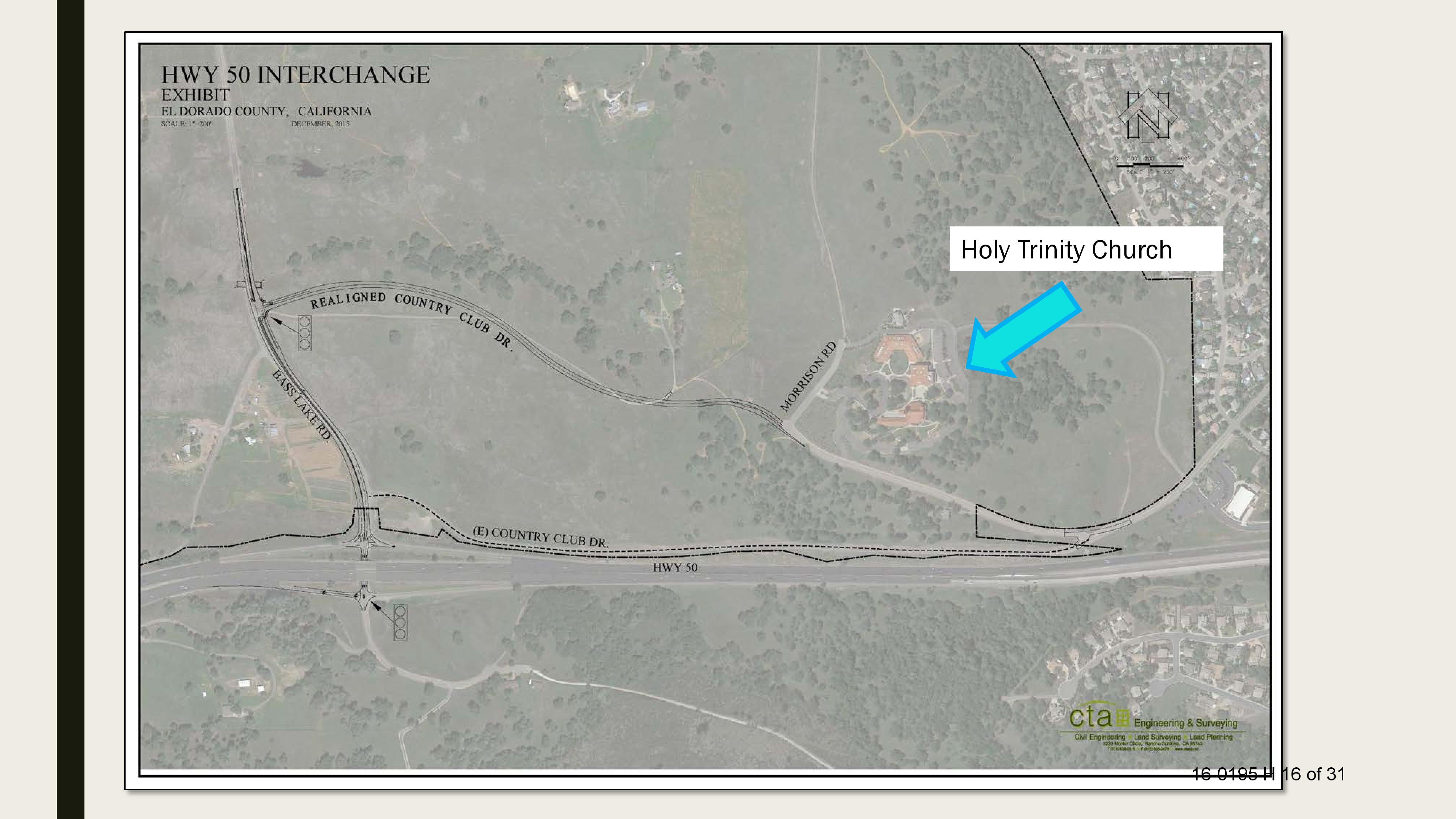
Community Development Services, Department of Transportation, recommending the Board approve and authorize the Chair to sign the Amended Cooperative Agreement A-1 to Cooperative Agreement 12-53501 with the El Dorado Hills Community Services District to extend the expiration date of the Agreement by two years to December 13, 2019, thereby allowing additional time to complete construction of the New York Creek Trail East Project – Phase 2, CIP 72308, as the Class 1 Bike Path improvements will not be completed by the end of the current term.
Agenda Item 21: Approved on the Consent Calendar
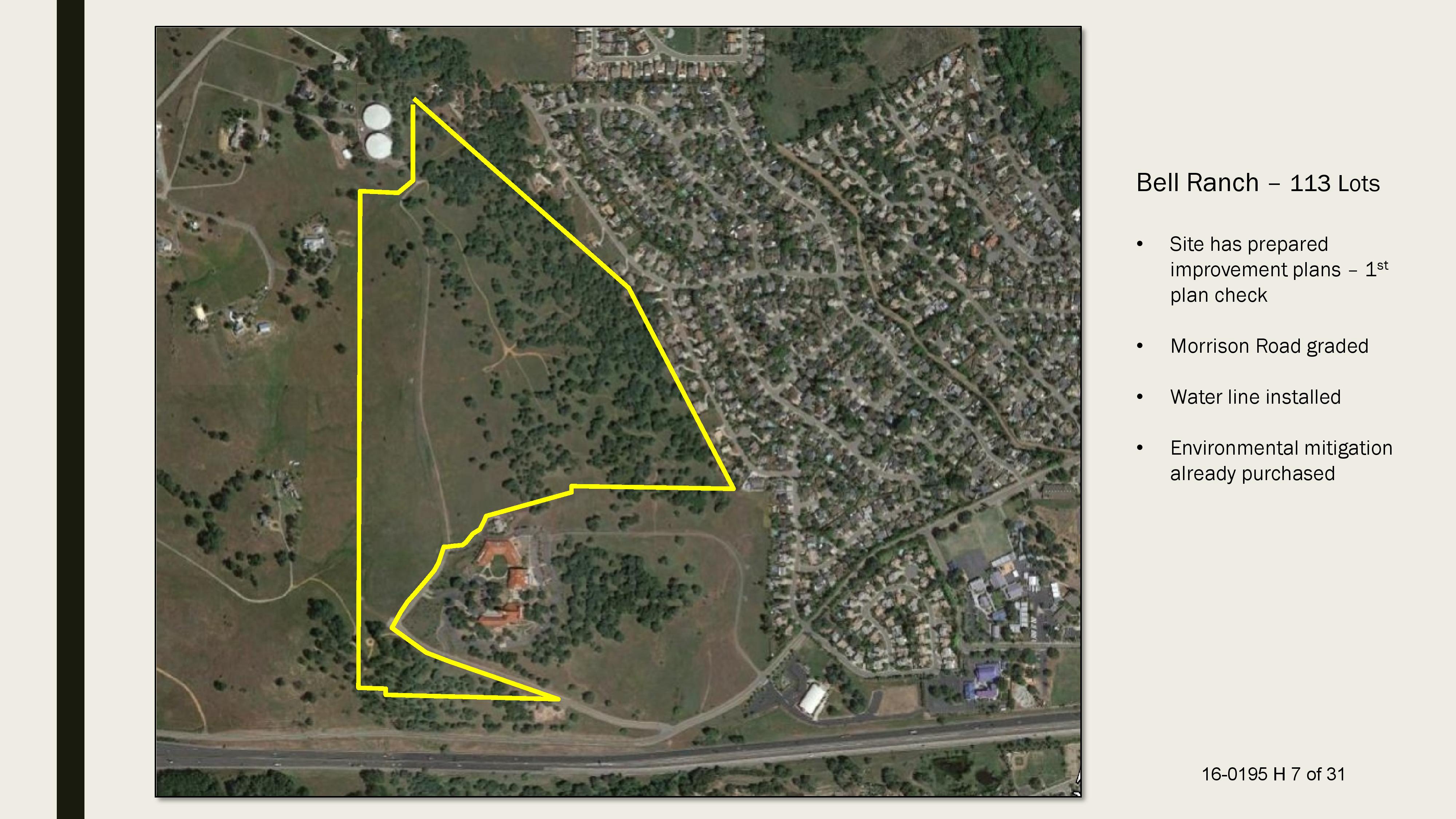
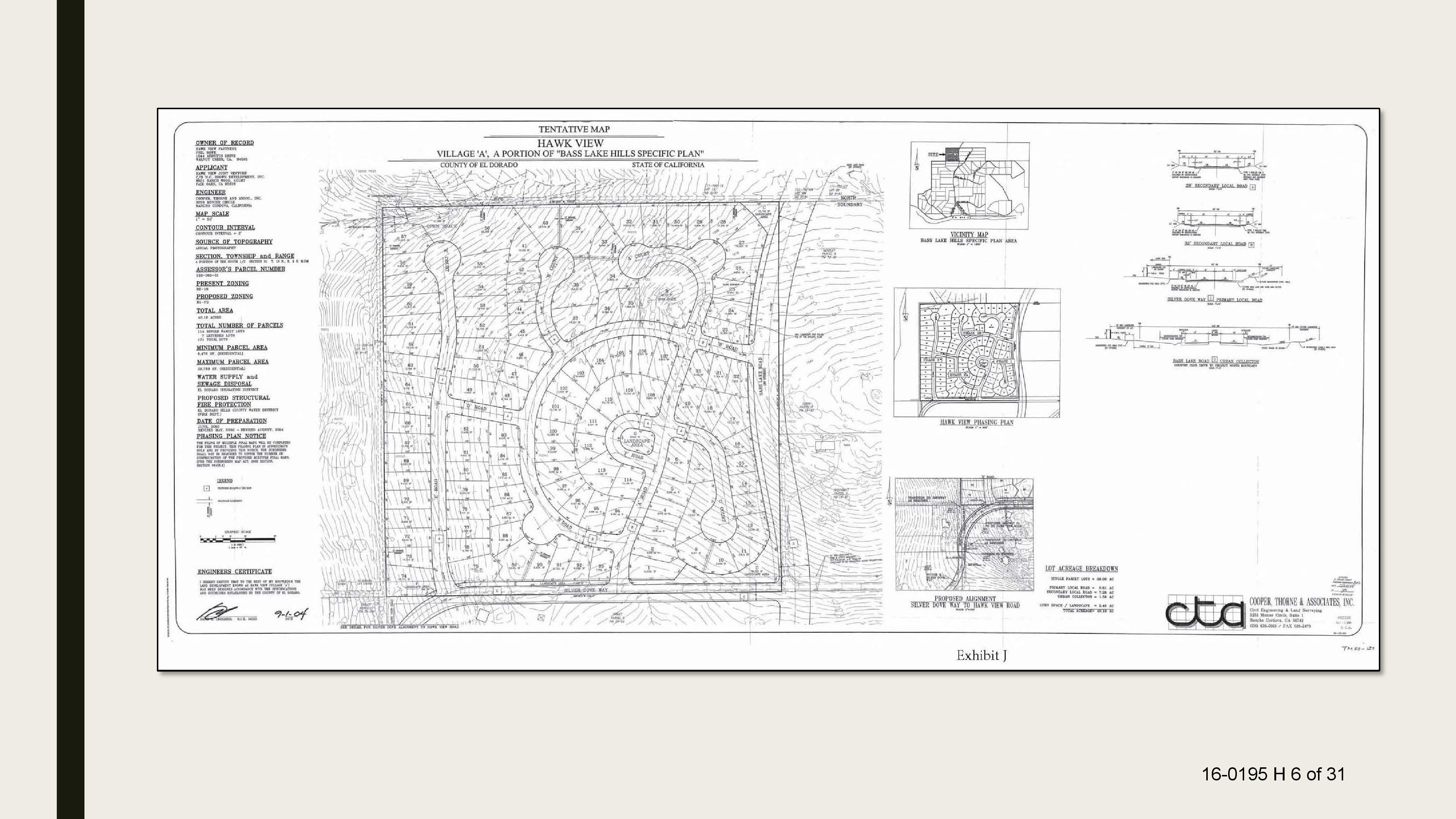
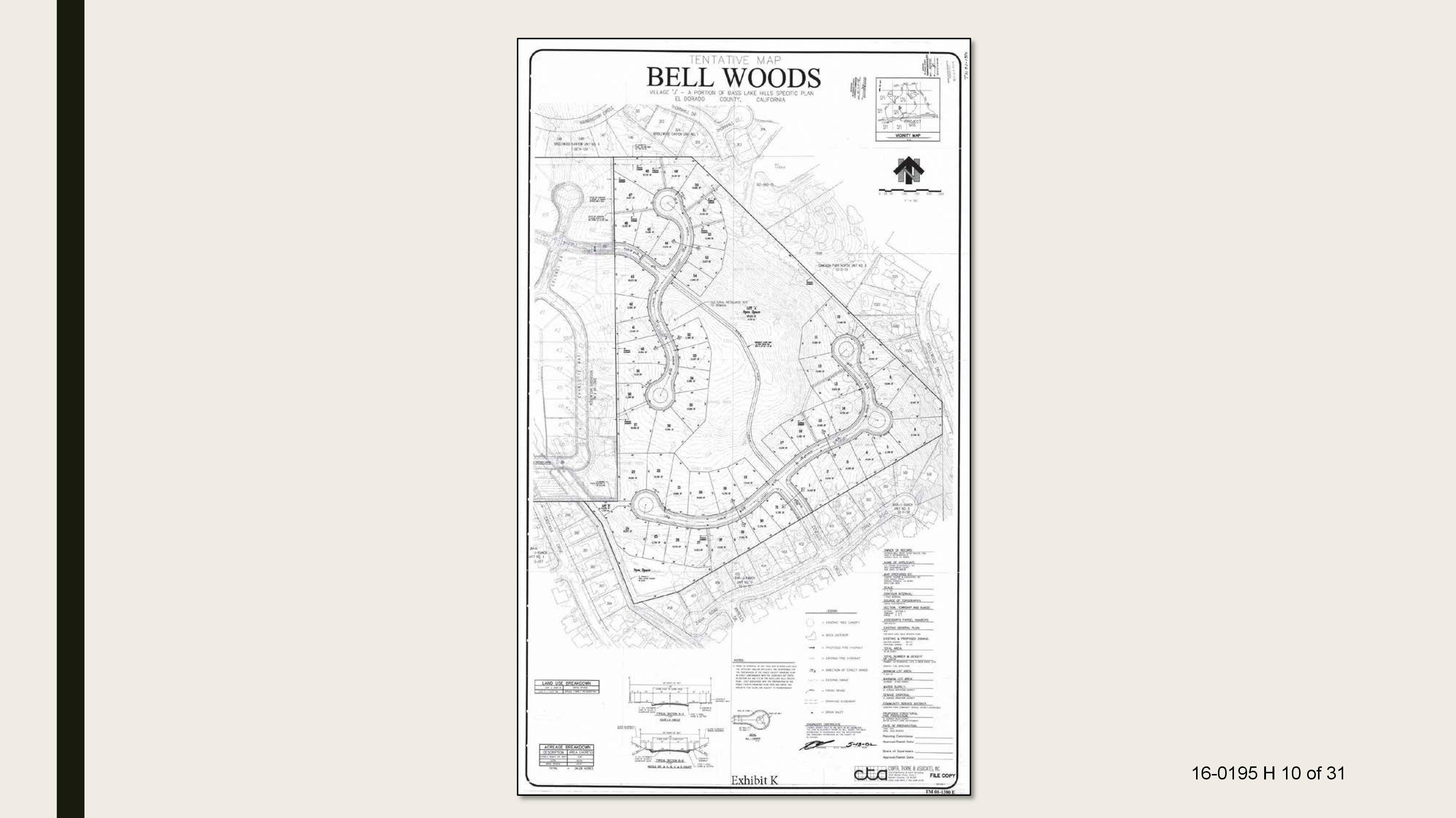
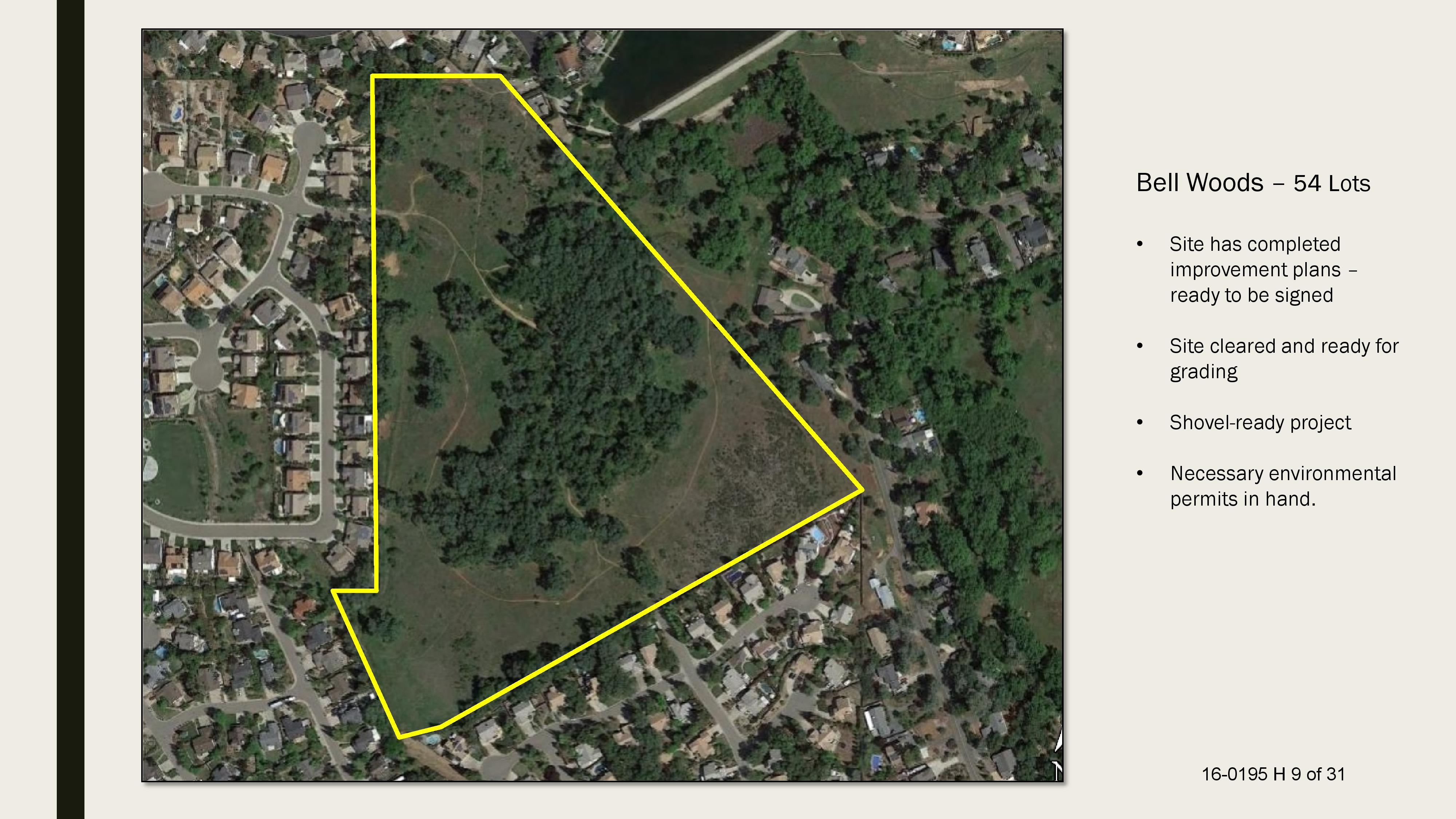
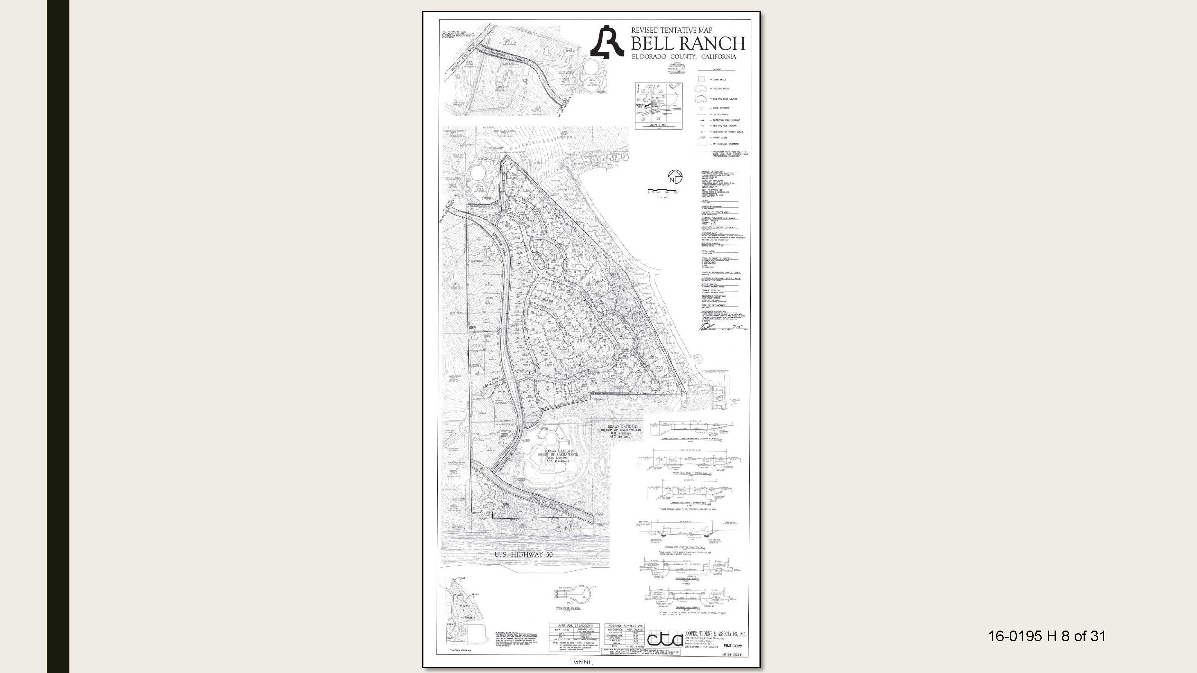
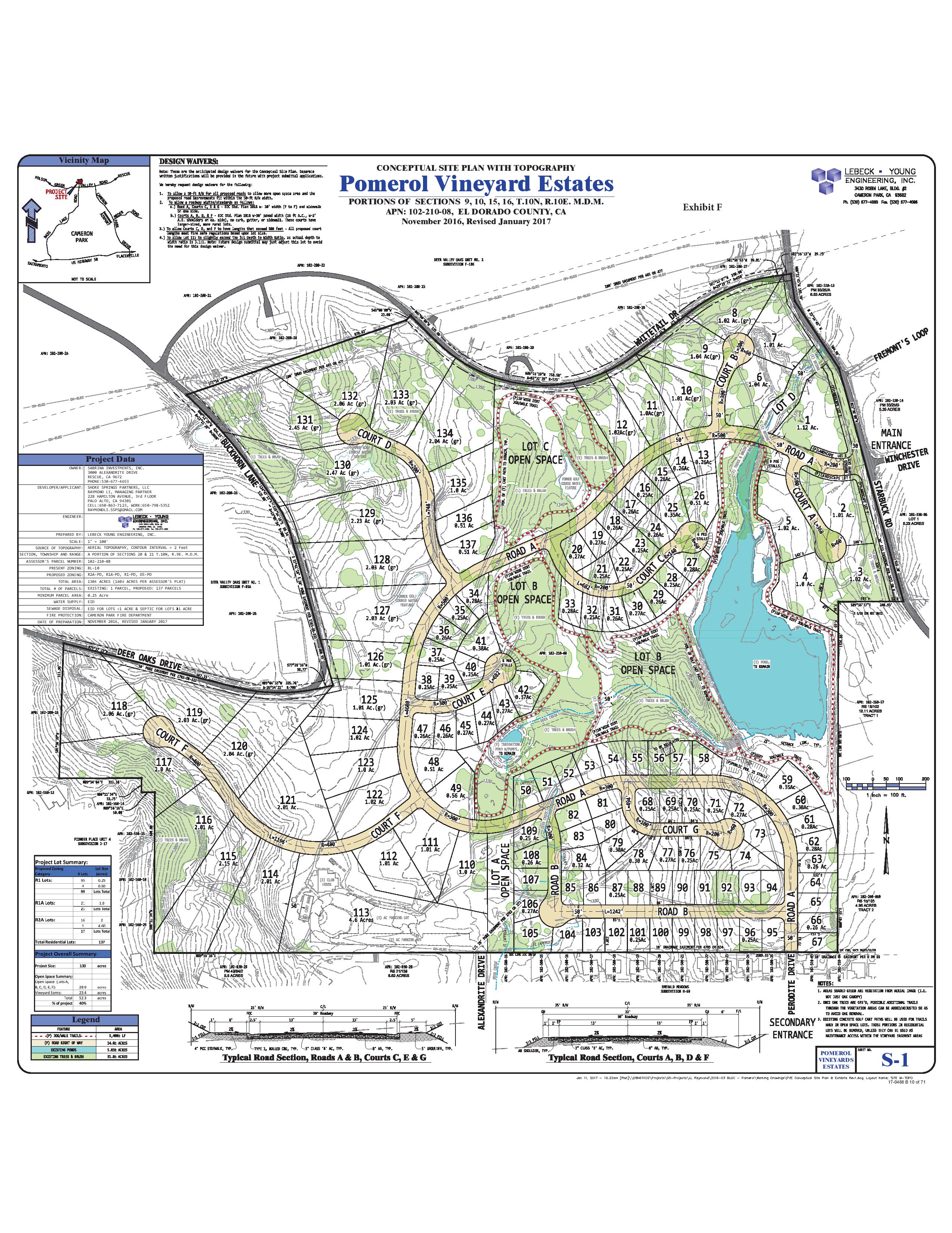
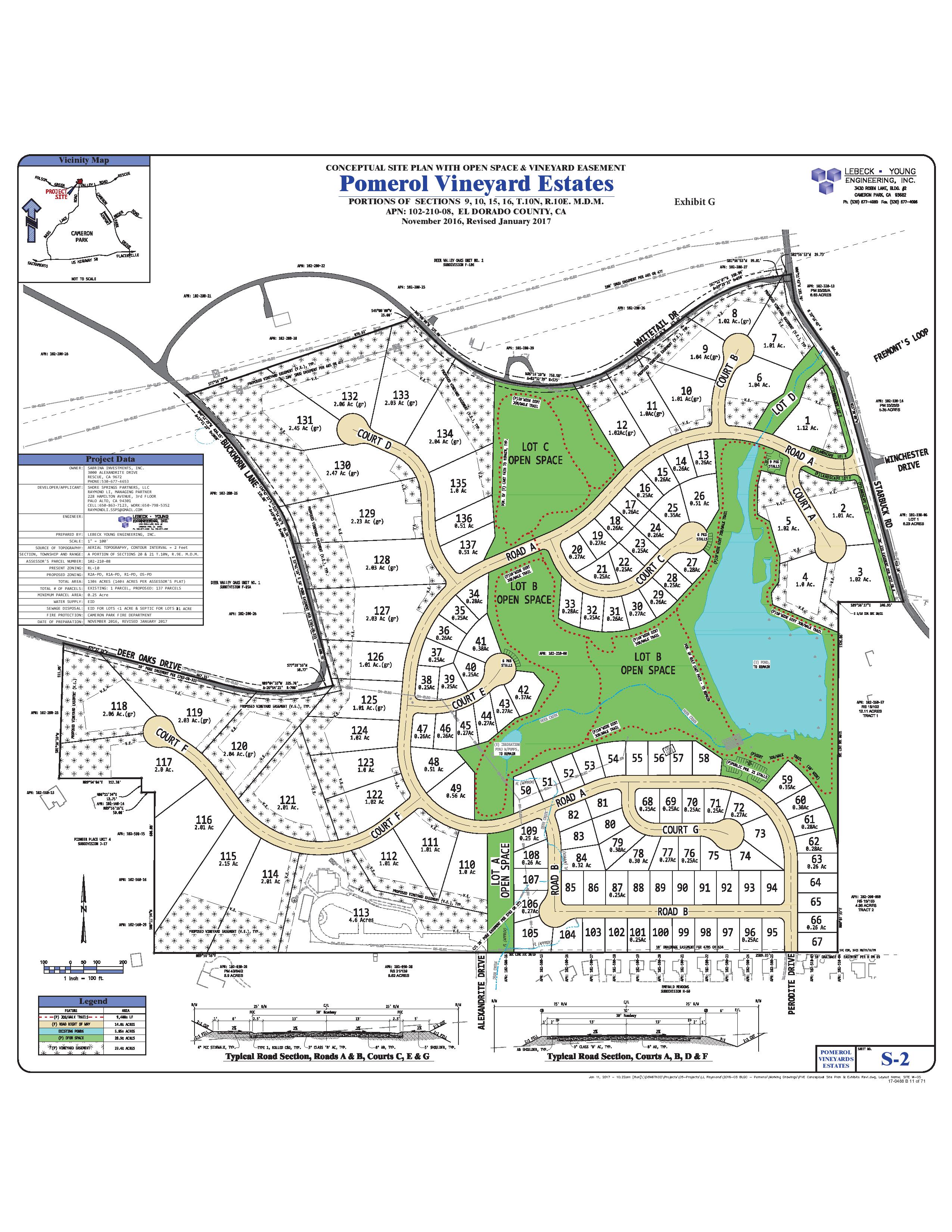
Community Development Services, Planning and Building Department, submitting for approval the Final Map (TM06-1428-F-1) for Carson Creek Unit 2A, Phase 1 Subdivision, creating a total of 186 lots consisting of 170 residential lots, 10 lettered lots, 6 large lots, and Investment Boulevard on property identified as Assessor’s Parcel Numbers 117-570-14, 117-570-15, and 117-570-20, located on the south side of Carson Crossing Drive, approximately 0.45 mile west of the Golden Foothills Parkway and Latrobe Road intersection, in the El Dorado Hills area, and recommending the Board consider the following: 1) Approve the Final Map (TM06-1428-F-1) for the Carson Creek Unit 2A, Phase 1 Subdivision; and 2) Approve and authorize the Chair to sign the Agreement to Make Subdivision Improvements
Agenda Item 32: Approved 5-0
HEARING – Community Development Services, Planning and Building Department, and County Counsel recommending the Board take the following action directed in the Peremptory Writ of Mandate dated September 1, 2017, in Alliance For Responsible Planning v. El Dorado County Board of Supervisors, et al. (Case PC20160346) adopt and authorize the Chair to sign Resolution 159-2017 approving the Court-ordered actions to strike out text of the Measure E amendments in the Transportation and Circulation Element, Policies TC-Xa 3, TC-Xa 4, TC-Xa 6, and TC-Xf, restoring those policies to the language in effect immediately prior to the July 29, 2016, effective date of Measure E, and add the identified Measure E “Implementation Statements.”
Agenda Item 34: Approved 5-0
Motion to Adopt Resolutions 127-2017, 128-2017, 129-2017 and 130-2017
Approved 5-0
Motion to Adopt Ordinance 5061
Approved 5-0
Motion to
1) Return to the Board within 12 months with a report on implementation of the Project;
2) Include in the report a complete inventory of the oak trees removed per discretionary or ministerial project with the following data: quantity, species, trunk diameter (dbh), percentage of individual oak tress and/or percentage of acreage of oak woodlands removed;
3) Include in the report the number of Individual Native Oak trees between 24 and 36 inches (dbh) removed within Oak Woodland Areas; and
4) Include in the report the number of Heritage Trees removed per project with the following data: quantity, species and trunk diameter (dbh)
Approved 5-0
LIMITED HEARING – To consider the Planning Commission’s recommendation and receive public comment only on the proposed modifications to General Plan Measure CO-K and the modifications to the proposed Oak Resources Conservation Ordinance that were considered by the Planning Commission on September 28, 2017, as directed by the Board of Supervisors on October 10, 2017. (The public hearing on the overall Project was closed on July 18, 2017 and remains closed.) After the close of the limited public hearing, staff recommends the Board consider the recommendation of the Planning Commission and then consider certification of the Environmental Impact Report and approval of the overall Project. Community Development Services, Planning and Building Department, recommending the Board consider the General Plan Biological Resources Policy Update, Oak Resources Management Plan, and Oak Resources Conservation Ordinance, collectively the proposed Project, consisting of specific revisions to biological resources objectives, policies, and implementation measures
Agenda Item 35:
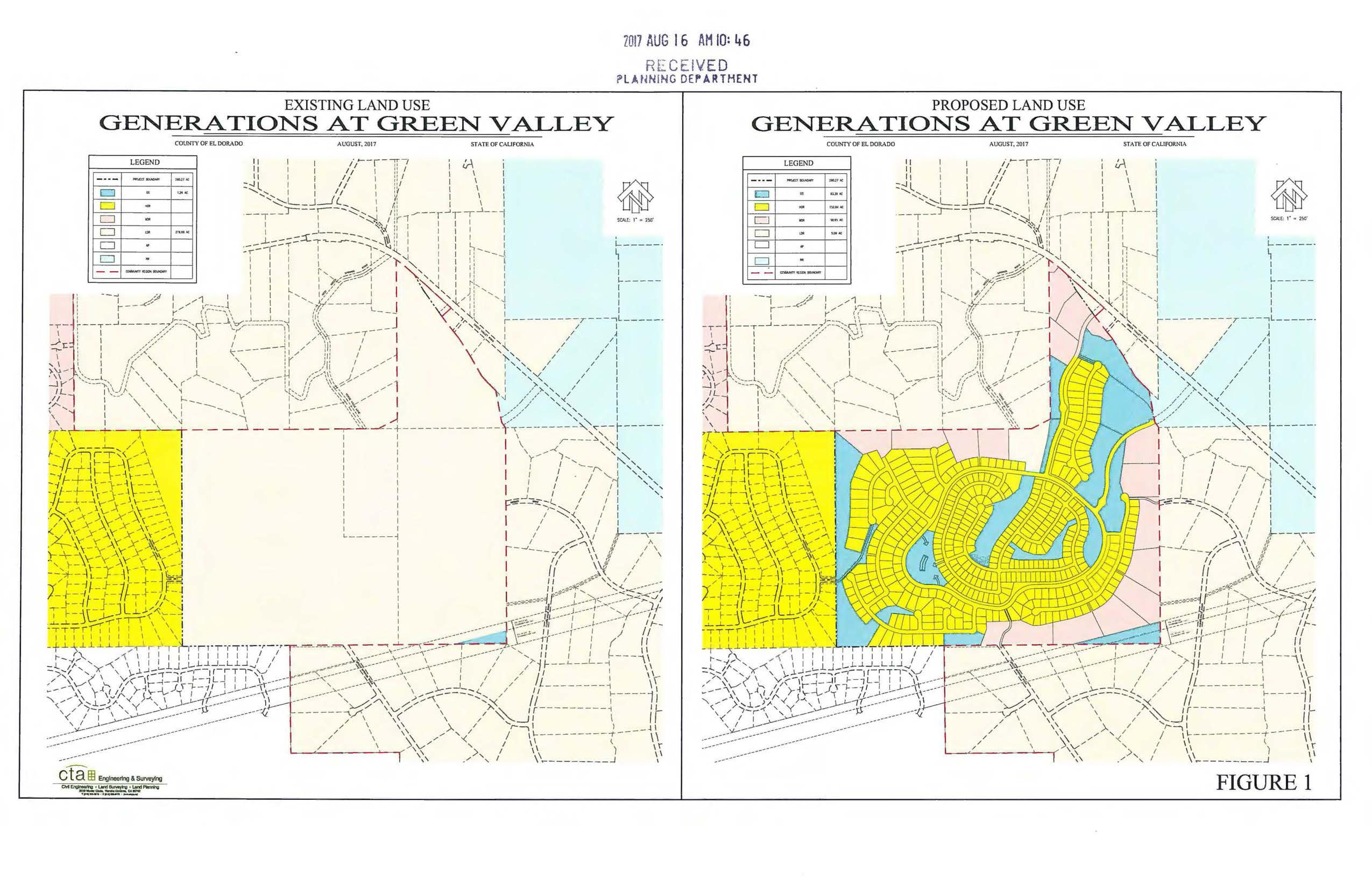
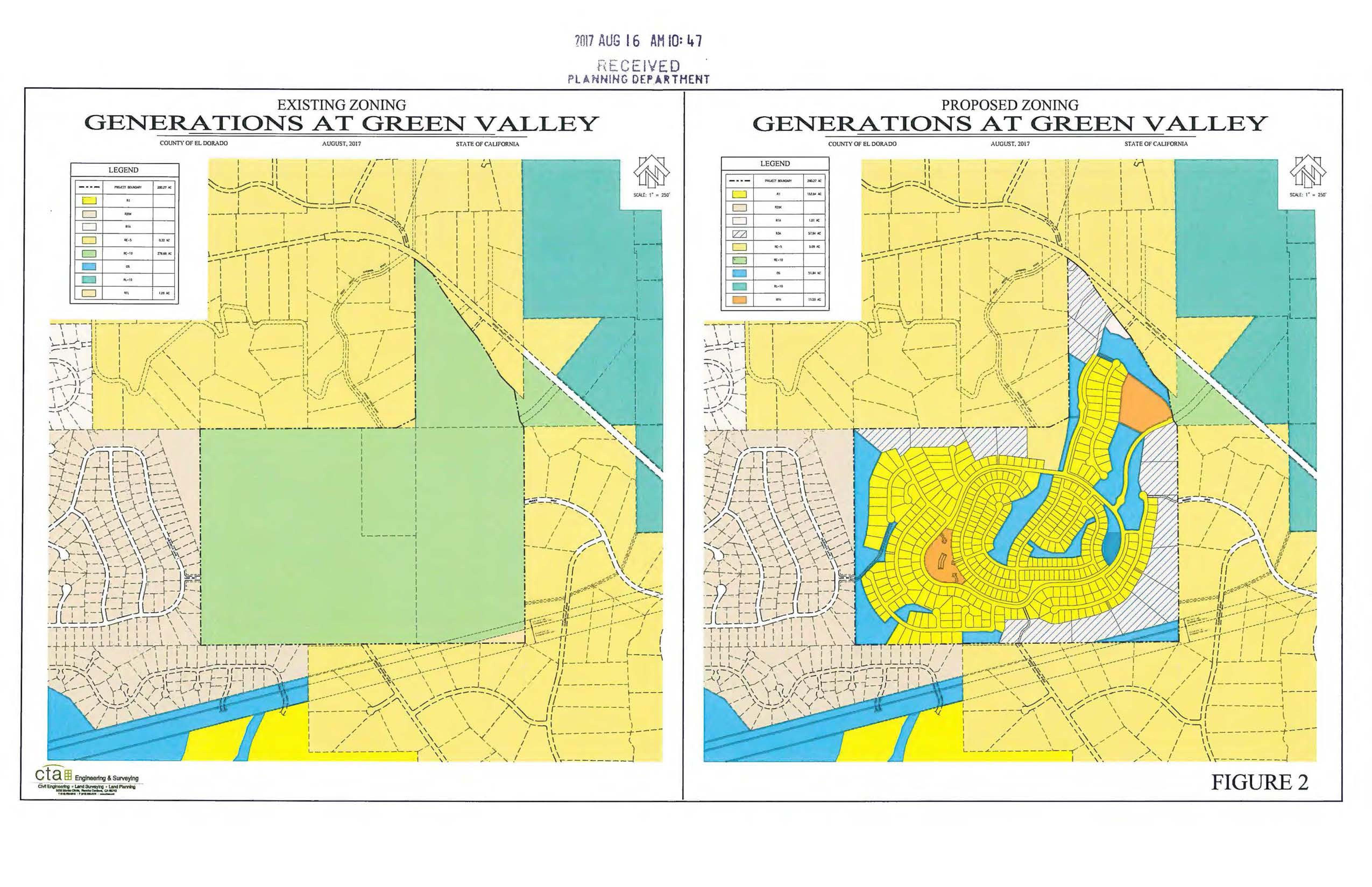
No Formal Action taken. The Board gave the developer feedback through their discussion regarding maintaining quality of life, traffic, schools, safety, high density housing in rural areas and affordable housing
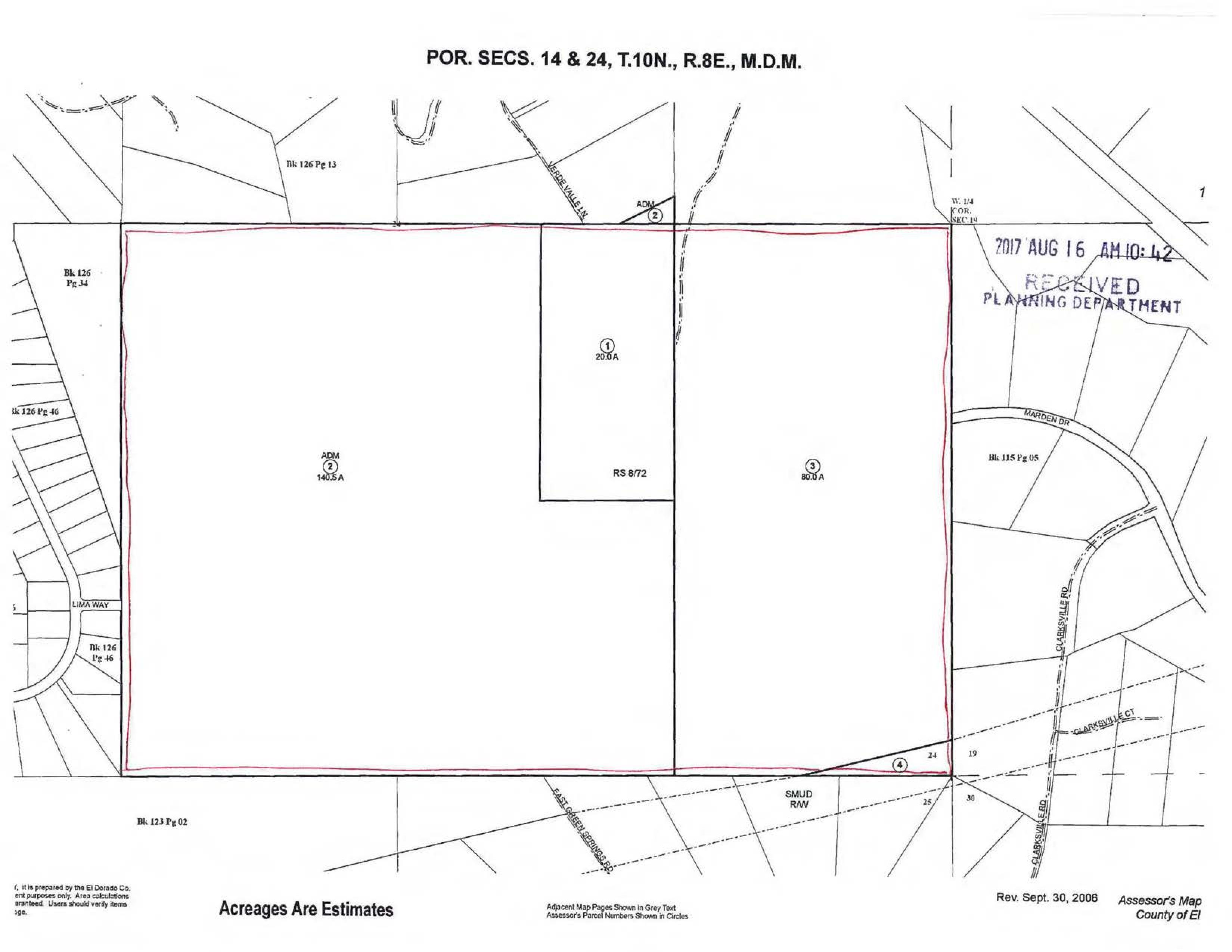
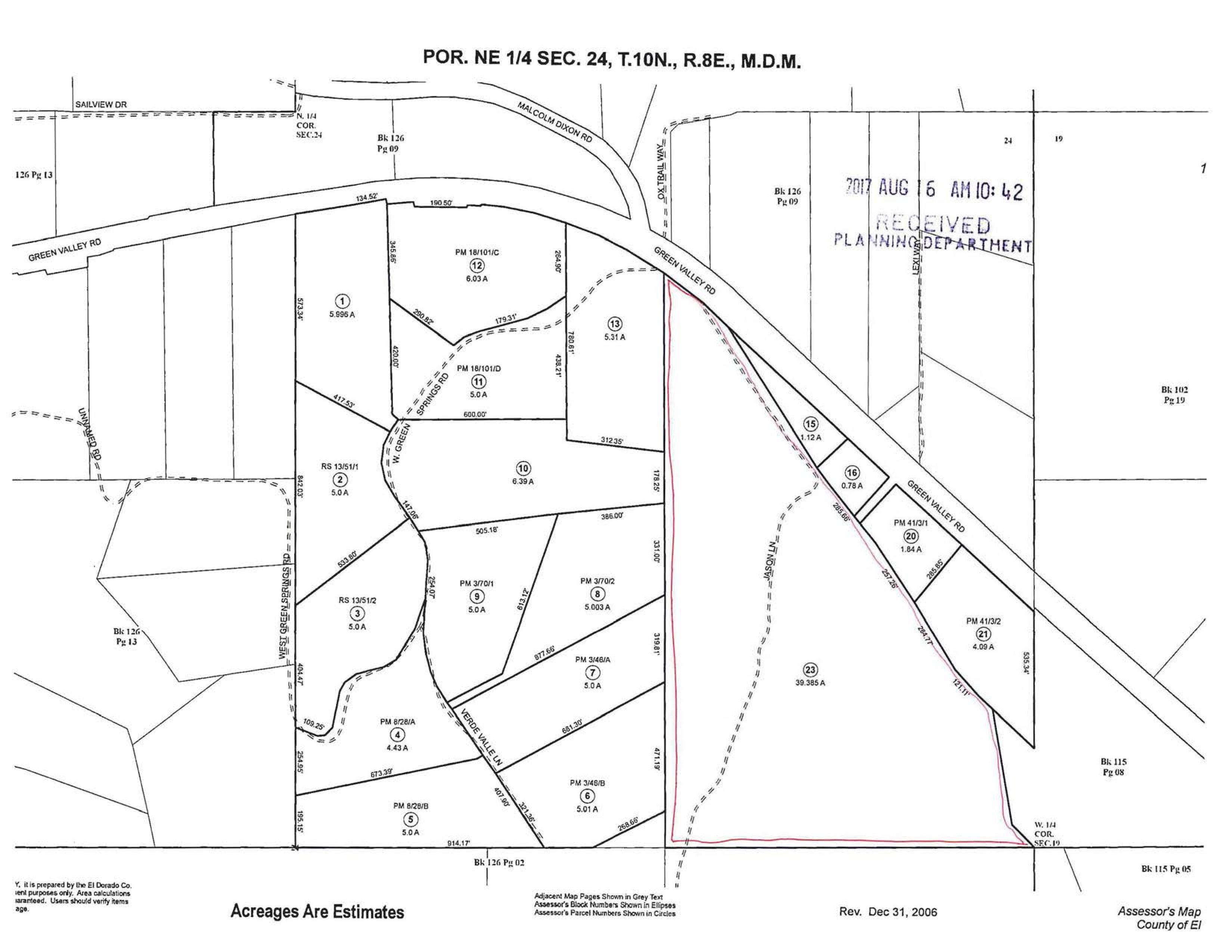
Community Development Services, Planning and Building Department, forwarding a request from True Life Companies for an Initiation Hearing, a conceptual review for discussion purposes only, for a General Plan Amendment from Low-Density Residential to Medium- and High-Density Residential (Pre-Application PA17-0002/Generations at Green Valley); the proposed project would require future Rezone and 439-residential lot Tentative Subdivision Map discretionary approvals, for property identified by Assessor’s Parcel Numbers 126-020-01, 126-020-02, 126-020-03, 126-020-04, and 126-150-23, consisting of 280 acres located in the El Dorado Hills area. (Supervisorial District 4)
EDH APAC BOS Meeting Minutes Document Page